Adony Logistics Centre Ltd is located almost in the middle of the country. By road, it is 55 km south of Budapest, 45 km from the M0 motorway and 75 km from Liszt Ferenc International Airport. Its western neighbour is the M6 motorway, 5 km away, which connects Hungary from north to south. At the same time, the M6 motorway connects to the M8 motorway, which connects the eastern and western parts of Hungary, about 20 km to the south.
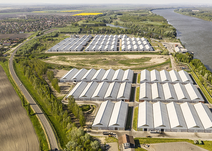
As regards shipping, we are located on the right bank of the Danube between river kilometres 1597 and 1598, on Helsinki corridor VII, which makes us an active part of both the northbound and southbound Danube trade.
As regards railways, our network of private sidings is connected to the national and international rail network by Adony station and, from there onwards, by Pusztaszabolcs.
In this location with excellent accessibility, the area between the two sites of our Centre, with a usable area of about 4 hectares, offers an investment opportunity for prospective investors.
For detailed information, you can find our contact details under Contacts.
Let’s plan together a fruitful investment for the future!
MAIN FEATURES OF OUR SITE IN FIGURES
- GPS coordinates:
- N 47° 6' 45.18” - E 18° 52' 28.17”
- River kilometre:
- Danube 1,598.00–1,597.00
- Off-ramp from the M6 motorway:
- Off-ramp No 50 to Szabadegyháza/Adony
- Railway:
- Pusztaszabolcs main line, Adony station
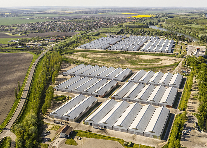
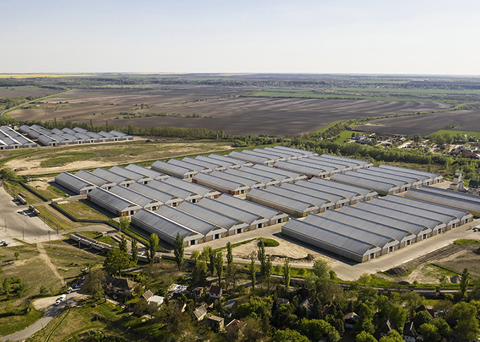
- Covered storage capacity:
- 170.000 m2 in total
- Number of warehouses:
- 84 flat storage halls, each with a ridge height of 12 m, and a total storage capacity of up to 500,000 tonnes of grain
- Length of port:
- 1000 m;
- Berths:
- 3 berths with a total capacity up to 750 tonnes of grain per hour
- Total length of railway tracks:
- private siding with a total length of 1.82 km
- Dryer and cleaner:
- STELA MDB-XN-2/12-SU, capacity: 40/60 tonnes/hour, licence number: 838-1/2009/MU
- Weighbridges:
- Metler Toledo, certified; 6 weighbridges, each with a 60-tonne capacity
- Location of reference water-level scale:
- Danube river kilometre 1,597+794,
- Typical levels:
-
cmABSL*
- Lowest water level for navigation:
-
-691,66
- Highest water level for navigation:
-
53197,03
- The port’s operating water levels:
-
Berths 2 and 3: Min. 539 cm at Adony
Berth 5: Min. 403 cm at Adony